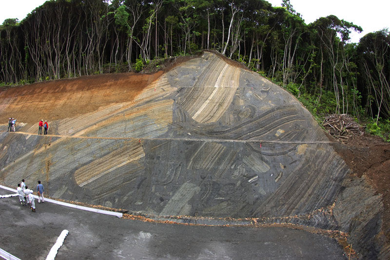

I tweeted an image that got a lot of attention the other day and wanted to follow it up with a quick post describing the deposit. The back story is this: Lesli Wood, a submarine landslide expert, showed an image at a recent conference that is a spectacular example of a mass transport deposit (MTD), or more simply, a submarine landslide deposit. Landslides occur on land (example video), causing plenty of infrastructure damage and other problems. While they are difficult to view and visualize, landslides also occur on the seafloor, causing massive reorganization of the seafloor that can generate tsunamis. In fact, the Storegga slide that occurred offshore Norway about 6000 B.C. likely killed many Europeans.
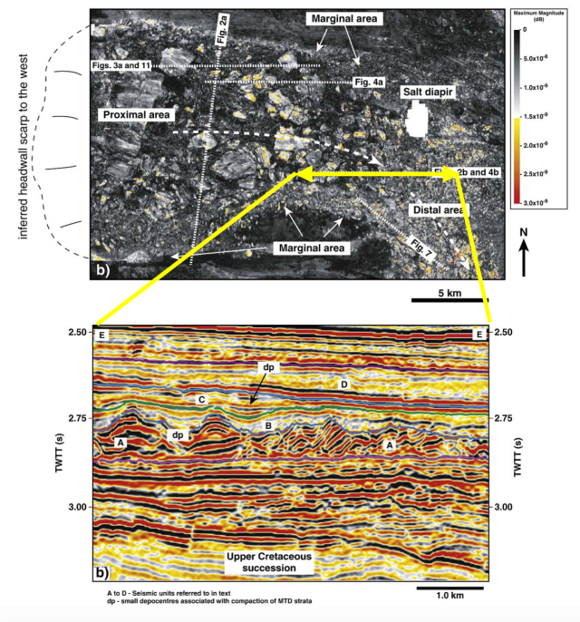
Due to their volume and size, submarine landslides are usually characterized best with seismic reflection data – the map and cross section below from this paper by T.M. Alves. The map shows large blocks of rock that have been broken apart and transported downslope (from left to right) and the cross section shows what the internal character of those blocks are. Note the discordant nature of the blocks, very similar to the image above of the outcrop, with rocks in all directions.
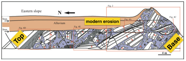
Outcrops usually are too small or not well enough exposed to view these types of features, but the outcrops created by road making on the Boso Peninsula in Japan are definitely good enough. This paper by Yamamoto et al (download the paper here)describing these outcrops has a very nicely drawn diagram that demonstrates the deposit. There are probably two landslide deposits that are stacked here, with a turbidite separating them (grey layer in the middle of the diagram).
Here is another nice photo from a field symposium website showing a closeup of the deposit. 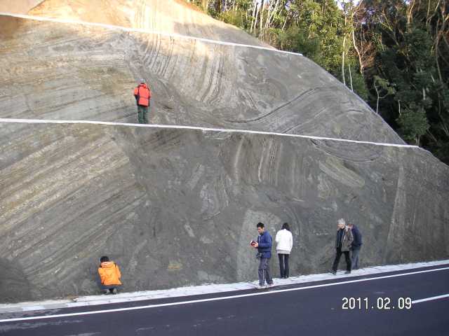

“Due to their volume and size, submarine landslides are usually characterized best with seismic reflection data”…I think this statement is true only for mass-movement deposits buried by undisturbed strata out on the rise where acoustic interference is minimal. Otherwise, sidescan sonar does a much better job of revealing morphology and planimetric extent, head and toe features, etc. I urge you to investigate the USGS SeaMarc I and GLORIA data from the 80’s. I participated in the surveys and unfortunately did not publish much, so a lot of earlier work based on seismic single-channel data still rules the literature, including recent pubs by Leslie Wood. If you have not seen it, check this out: “O’Leary, D.W. and Dobson, M.R., 1992, Southeastern New England Continental Rise: origin and history of slide complexes. In: Poag, C.W. & Graciansky, P.C. (eds) Geologic Evolution of Atlantic Continental Rises. Van Nostrand Reinhold, New York, p. 214-261.”
Another publication on blocks is coming up on Marine and Petroleum Geology this summer (2015). Keep tuned! Tiago
Hi Tiago, I look forward to it – I am reading the Gamboa paper now – very nice treatment of the measurements of canyons/channels!
Nearly there, nearly there! Meanwhile, there’s another one just hot from the press. Blocks just keep appearing on seismic…
http://www.sciencedirect.com/science/article/pii/S0040195115000815
All the best
Check out this new paper by Tiago Alves – its an open-access review paper on submarine slide blocks – amazing images!
http://www.sciencedirect.com/science/article/pii/S0264817215001592
The official site for all things mass wasted! Significance of Modern and Ancient Subaqueous Slope Landslides (S4SLIDE for short). This is an initiative by the International Geoscience Programme (IGCP) and Unesco.
https://sites.google.com/a/utexas.edu/s4slide/home
Excellent insights at outcrop scale and seismic examples – keep up the good work
Very interesting and useful information.
Pingback: Εντοπισμός Υποθαλάσσιου Κατολισθητικού Φαινομένου στη χερσόνησο Boso της Ιαπωνίας – Geographic Information Systems (GIS) TRAINING & SERVICES